battle, major, ancient
Battle of Idistaviso
Battle of Idistaviso was a battle fought in AD 16 at Idistaviso, in what is now Germany. It was part of Early Imperial campaigns in Germania, which ran from 12 BC to AD 16. The recorded result: Roman victory.
See it on the globe Read the article

Where it sits in Early Imperial campaigns in Germania
Record
| Date | AD 16 (year precision) | |
|---|---|---|
| Place | Idistaviso, Germany 52.190N, 9.021E | |
| Kind | Battle, ancient | |
| Strength | 8 legions; 26 cohorts; 8 alae; Praetorian Guard; Additional allied Germanic contingents; Total: at least 60,000 men | Unknown |
| Casualties and losses | Unknown | Unknown |
| Commanders |
|
|
The ground today

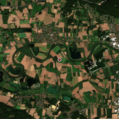
The recorded site stands at about 53 m; within 10.0 km the ground runs from 0 to 333 m, 333 m of relief, hilly country and today it is 45% cropland, 25% grassland, 18% tree cover.
Elevation from the Copernicus DEM GLO-30 (ESA, Airbus); land cover from ESA WorldCover 2021 (CC BY 4.0), within about 5 km of the recorded site. Computed, not recorded.Nearest engagements
- Battle of Vlotho 1638, 12 km W
- Siege of Minden 1758, 13 km NW
- Battle of Oldendorf 1633, 16 km E
- Battle of Minden 1759, 18 km NW
- Battle of Gohfeld 1759, 18 km W
In the same war
- Before: Battle of the Teutoburg Forest September AD 9
- After: Battle of the Angrivarian Wall AD 16
- All 4 engagements of Early Imperial campaigns in Germania
Battle of Idistaviso is one of 63 engagements of the 1st century in the atlas and one of 668 in present-day Germany.
Sources
Identity, coordinates, dates and the war from Wikidata Q630644, released under CC0. Result, belligerents, commanders, strength and casualties from the infobox of the English Wikipedia article Battle of Idistaviso, revision 1382492074, read 2026-11-14, licensed CC BY-SA 4.0; the article's text is not reproduced here. Present-day country and state from Natural Earth. Dates before 1582 follow the Julian calendar as recorded.