Atlas of Battles

battle, major, interwar and Second World War

Japanese invasion of Manchuria

Japanese invasion of Manchuria was a battle fought in 1931 at Inner Manchuria, in what is now China; it ran into the following year. Its exact site is not recorded; the atlas places it at Inner Manchuria. It was part of Second Sino-Japanese War, which ran from 1937 to 1945. The recorded result: Japanese victory; Tanggu Truce. Recorded strength: 30,000–60,450 men against 160,000 men.

See it on the globe Read the article

Fought1931ran into the following year
WhereInner Manchuria, China45.000N, 125.000E, placed at the location, approximate
OutcomeJapanese victory; Tanggu Truce
BelligerentsEmpire of Japan; Manchukuo (from 1932); Chinese collaboratorsagainstRepublic of China (1912–49)
Part ofSecond Sino-Japanese War1937 to 1945

Where it sits in Second Sino-Japanese War

Japanese invasion of Manchuria, 1931Jiangqiao campaign, 1931Jinzhou Operation, 1931Defense of Harbin, 1932Battle of Wenzaobang, 1932Suiyuan Campaign, 1936Battle of Nanking, 1937Bombing of Songjiang, 1937Siege of Shanghai, 1937Battle of Luodian, 1937Bombing of Nanjing, 1937Marco Polo Bridge incident, 1937Battle of Beiping–Tianjin, 1937Operation Chahar, 1937Battle of Zhangjiakou, 1937Battle of Nankou, 1937Battle of Shanghai, 1937Bloody Saturday (Shanghai), 1937Battle of Wusong, 1937Battle of Taiyuan, 1937Battle of Datong, 1937Battle of Jining, 1937Battle of Xinkou, 1937Battle of Pingxingguan, 1937Defense of Sihang Warehouse, 1937Battle of Jinshanwei, 1937USS Panay incident, 1937Amoy Operation, 1938Bombing of Chengdu, 1938Defense of Linyi, 1938Siege of Xuzhou, 1938Battle of Northern and Eastern Henan, 1938Bombing of Chongqing, 1938Defense of Teng County, 1938Battle of Taierzhuang, 1938Battle of Xuzhou, 1938Canton Operation, 1938Battle of Wuhan, 1938Battle of Changsha, 1939Swatow Operation, 1939Hainan Island Operation, 1939Battle of Nanchang, 1939Battle of Suixian–Zaoyang, 1939Battle of South Guangxi, 1939Battle of Baotou, 1939Battle of Kunlun Pass, 1939Battle of West Suiyuan, 19401939–1940 Winter Offensive, 1940Battle of Wuyuan, 1940Battle of Zaoyang–Yichang, 1940Hundred Regiments Offensive, 1940Battle of South Henan, 1941Battle of Shanggao, 1941Battle of South Shanxi, 1941Battle of Changsha, 1941proposed Japanese invasion of Sichuan, 1942Battle of Changsha, 1942Battle of Tachiao, 1942Battle of Oktwin, 1942Battle of Toungoo, 1942Battle of Yenangyaung, 1942Battle of Lashio, 1942Battle of Yunnan-Burma Road, 1942Battle of West Hubei, 1943Battle of Northern Burma and Western Yunnan, 1943Battle of Changde, 1943Battle of Longling, 1944Battle of Dushan, 1944Battle of Central Henan, 1944Operation Ichi-Go, 1944Battle of Changsha, 1944Defense of Hengyang, 1944Battle of Guilin–Liuzhou, 1944Second Guangxi campaign, 1945Battle of West Hunan, 194519311945Japanese invasion of Manchuria, 1931
77 placed engagements of Second Sino-Japanese War in time order; taller ticks are more widely documented. Each tick is a link.

Record

Date1931 (year precision)
to 1932
PlaceInner Manchuria, China
45.000N, 125.000E
KindBattle, interwar and Second World War
Territorial changeManchuria seized by the Kwantung Army; Establishment of Manchukuo as a Japanese puppet state
Strength30,000–60,450 men160,000 men
Casualties and lossesWestern historians' estimate: 10,000 dead from all causesWestern historians' estimate: 50,000 military and civilian dead from all causes; Chinese claim: Northeastern Army: 4,890 dead; Police force: 244 dead; Anti-Japanese Volunteer Armies: 6,675 dead; 4,108 Chinese civilians dead
Commanders
  • Shigeru Honjō
  • Jirō Tamon
  • Senjuro Hayashi
  • Puyi
  • Zhang Haipeng
  • Zhang Xueliang
  • Ma Zhanshan
  • Feng Zhanhai
  • Ding Chao
Japanese invasion of ManchuriaJapanese invasion of ManchuriaSiege of ChangchunSiege of ChangchunHarbinBaichengSongyuanJiutaiZhaodongNonganShuangchengTaonan100 km45.000N, 125.000E
Placed at Inner Manchuria; the exact site is not recorded. with the nearest other engagements in the atlas. Present-day coastlines, rivers and borders; towns from Natural Earth.

The ground today

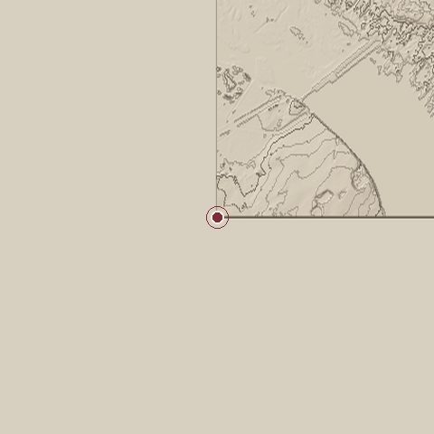
Relief of the ground around the site of Japanese invasion of Manchuria
Relief within about 10.0 km of the site, contours every 10 m. Copernicus DEM GLO-30, ESA.
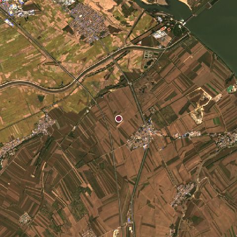
Satellite view of the site of Japanese invasion of Manchuria today
The same ground from Sentinel-2 on 2023-10-05. Contains modified Copernicus Sentinel data 2023.

The recorded site stands at about 0 m; within 10.0 km the ground runs from 0 to 200 m, 200 m of relief, hilly country and today it is 70% cropland, 14% grassland, 5% tree cover.

cropland: 70%grassland: 14%tree cover: 5%built-up: 5%water: 4%cropland 70%grassland 14%tree cover 5%built-up 5%water 4%
west to east, 10.0 km0 to 1 mnorth to south, 10.0 km0 to 166 m
Elevation from the Copernicus DEM GLO-30 (ESA, Airbus); land cover from ESA WorldCover 2021 (CC BY 4.0), within about 5 km of the recorded site. Computed, not recorded.

Nearest engagements

In the same war

Elsewhere in 1931

Japanese invasion of Manchuria is one of 4,429 engagements of the 20th century in the atlas and one of 448 in present-day China.

Sources

Identity, coordinates, dates and the war from Wikidata Q1551794, released under CC0. Result, belligerents, commanders, strength and casualties from the infobox of the English Wikipedia article Japanese invasion of Manchuria, revision 1383985574, read 2026-11-15, licensed CC BY-SA 4.0; the article's text is not reproduced here. Present-day country and state from Natural Earth. Dates before 1582 follow the Julian calendar as recorded.